
‘London is a mirror of mankind and of the world’
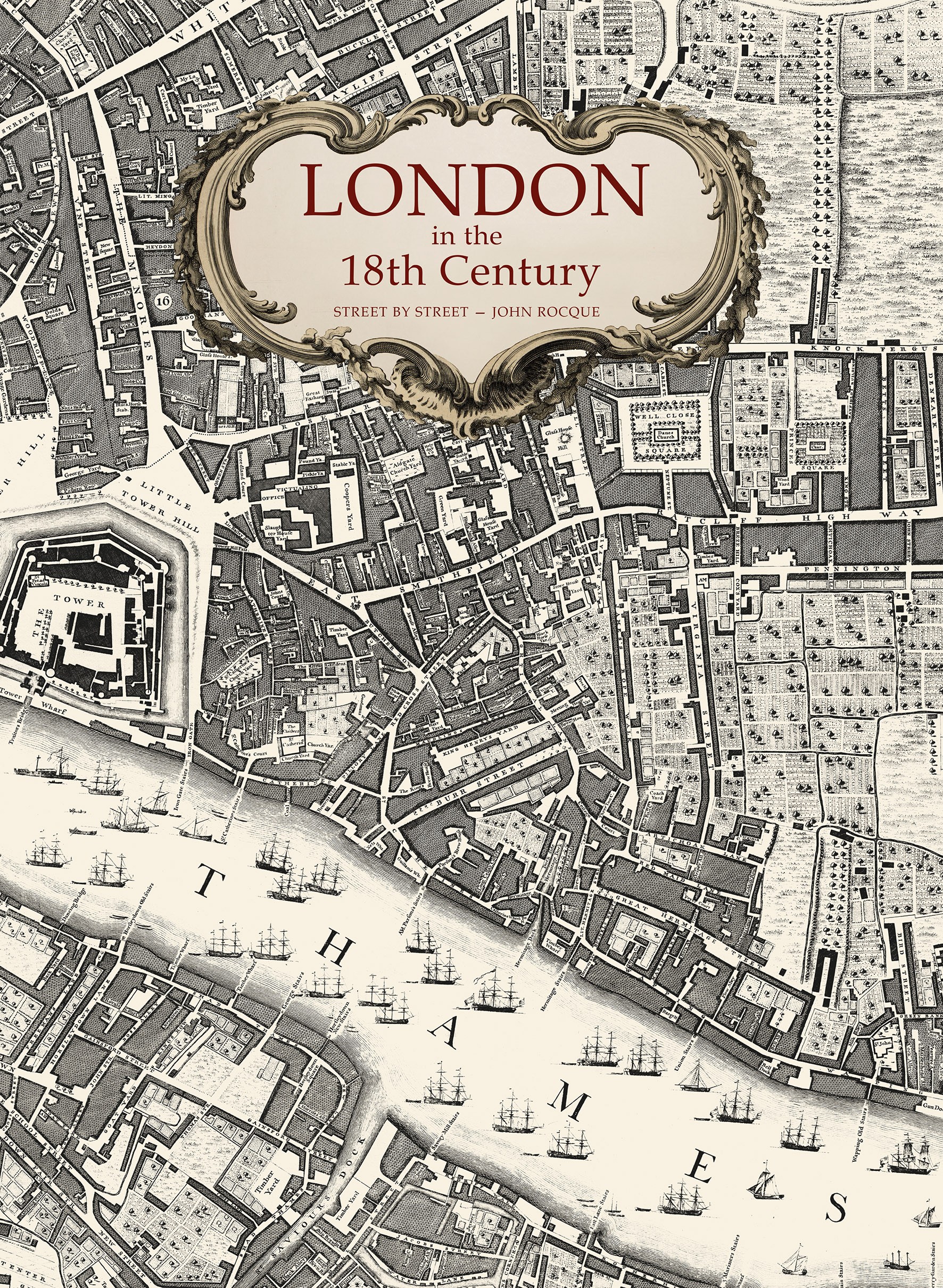
I recently became the proud owner of London in the 18th Century: Street by Street, a book of maps created by John Rocque in the 1700s and republished now with contemporary updates and information. Where we might feel surrounded by old fogeys forever complaining about ‘too much change’, this book highlights how very little has changed in 300 years, and most of that change could arguably be put down to Hitler’s Luftwaffe, writes Michael Holland.
Yes, there are big changes to my hometown of Rotherhithe; there were houses and wharves next to the riverfront, and just one dock, but the rest of the peninsula was then farmland. It is only when you get round to Bermondsey and London Bridge that you can see the beginnings of what would become South London as we know it today.
You can’t help but feel a connection to those times when you see streets that you walk along today: Redriff Road, Rotherhithe Street, Jamaica Road, Elephant Lane, Blue Anchor Road, Kent Road, Neckinger Road, Rope Makers Walk, Tooley Street, The Borough, Guy’s Hospital, Horselydown Lane and Shad Thames. The list of familiar places is endless.
The capital was much smaller then; the countryside began just after Shoreditch in the north, and just beyond Walworth in the south; you could walk the main thoroughfares in a day, yet Rocque, with his very basic surveying equipment, took nine years to make his map.
Steven Brindle is one of the UK’s leading historians, and one of the world’s leading authorities on the history of London, so he was asked by the publishers to ensure this latest edition gets everything right. Steven says, ‘The road markings and names are now crystal clear; you can see things like the gallows where Marble Arch now stands, and the clay pits used for making brick, as well as the newly built Buckingham Palace and its grounds.’
From an early age, Steven liked history: ‘I was always interested in castles and abbeys.’ After a degree in History, followed by a doctoral thesis about medieval architecture in Spain at Oxford, he started working with English Heritage as a historian, working his way up to Senior Properties Historian in the Curatorial Division, a role he has held since 2008. Steven is also the author of several books in his field of knowledge.
I wanted to know what this expert on old London thought contemporary Londoners would feel about this book:
‘They would see London as it was in 1746, in beautiful and accurate maps, 24 sheets covering the city as it was then, showing the fine detail of the city, broad outlines being recognisable, but lots of intriguing differences. You can still walk down many of the same streets and past many of the same buildings, parks, and squares on the map, but it also tells you the history; you can see the grand houses that are now museums or government buildings, and also the markets, clay pits, wells, and rivers that helped London to thrive.’
What are the highlights of the book?
‘Each section of Rocque’s detailed map reveals the stories of different areas of London. At a time when Bermondsey was the centre of ropemaking, there were watchmakers in Clerkenwell and weavers in Spitalfields. Where Marylebone fields was an area of scrubland used for duels and hampered by highwaymen, where Bethnal Green was a country retreat where gentlefolk went for fresh air, cake, and ale, where Mile End was a small country town, and Whitechapel was the city’s rubbish dump, where Bloomsbury had fresh water springs that were fed to water nearby Holborn, and where the city stopped at the river, with South London a land of fields, orchards, inns, farms, timber yards, and military camping grounds alongside the famous Vauxhall Gardens where all of society would convene for fashionable gatherings.’
I wanted to know what Steven’s favourite parts of the book were:
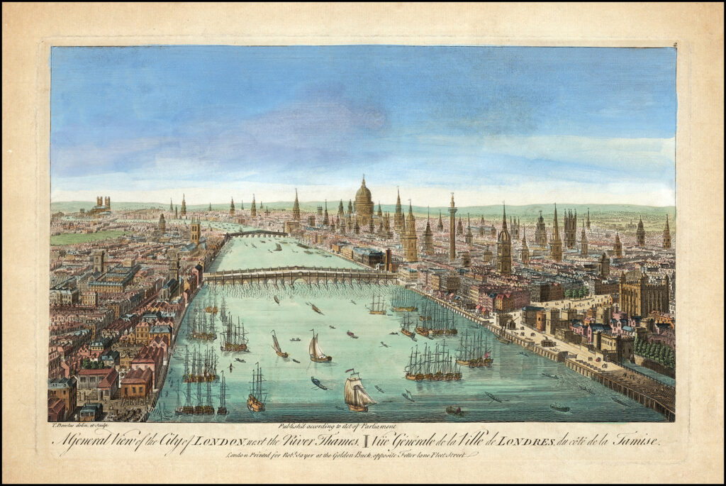
‘The map is so detailed. On the Thames, there are only two bridges, and you can see tall ships all up the Thames and then barges on the other side of the bridges. It really shows that London was this huge centre of commerce, and the Thames was a great highway for shipping and boats. People were more likely to cross the river by boat than by bridge. Then there is the growth of the West End. You can clearly see on the map the very different layout of the old medieval city of London with the new West End where grand mansions were going up surrounded by new streets and squares. It’s also quite incredible to see the way that the city was surrounded by gardens and orchards. All of South London is orchards and gardens to feed the city so that goods did not have to be transported too far. If you look on the map, areas that are now Islington, Camden, Tower Hamlets, Southwark, and Lambeth, are just fields – it’s quite extraordinary.’
Is history important?
‘History tells us who we are as a people and a nation. It explains how the world comes to be as it is, and what extraordinary achievements our ancestors made, through lifetimes of effort and immense skill, to create the economy, science, technology, culture, and civilisation that we live within and depend on, but often take for granted.’
Tell me about John Rocque:
‘He was an extraordinary man who achieved amazing things. Today we have satellite technology and photography, that creates Google Maps, and SatNav systems, so we know where we are the whole time. In the past, map-making involved much more down-to-earth skills, and huge effort by a few remarkable people like Mr Rocque.’
As we neared the end of our 18th Century London journey, Steven filled in the gaps:
Do you have a favourite London period?
‘The Victorian age, as the climax of British culture when London was the largest and richest city in the world.’
As a historian, do you embrace the changes London inevitably has to go through?
‘London is a world city, one of the most cosmopolitan and culturally richest places in the world. It has had this quality and status since the 18th century, since Rocque’s time. London is a mirror of mankind and of the world. To any historian, it is an exciting and inspiring place.’
Anything you’d like to add?
‘Thank you for your interest in our book. We are very proud of it!’
London in the 18th Century: Street by Street is published by Atlantic Publishing on 26th March and available from all good bookshops and online from Waterstones here: https://www.waterstones.com/book/london-in-the-18th-century/crawford-snowden/9781915143068